
Vertel uw vrienden over dit artikel:
Phanerozoic Paleocontinental World Maps - Cambridge Earth Science Series Rev edition
A. G. Smith
Prijs
€ 54,99
Besteld in een afgelegen magazijn
Verwachte levering 4 - 16 jul.
Onze klanten zeggen:

Voeg toe aan uw iMusic-verlanglijst
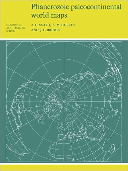
Phanerozoic Paleocontinental World Maps - Cambridge Earth Science Series Rev edition
A. G. Smith
This 1980 book shows the positions of the major continental areas during the past 560 million years as four series of computer-drawn maps, which provide a framework on which a wide variety of data may be plotted. Cylindrical equidistant and Lambert equal-area polar projections are used, with a thirty-degree latitude-longitude grid.
106 pages, maps, bibliography
| Media | Boeken Paperback Book (Boek met zachte kaft en gelijmde rug) |
| Vrijgegeven | 27 augustus 1981 |
| ISBN13 | 9780521232586 |
| Uitgevers | Cambridge University Press |
| Pagina's | 106 |
| Afmetingen | 210 × 279 × 6 mm · 260 g |
| Taal en grammatica | Engels |
Alles tonen
Meer door A. G. Smith


![Cover for A. G. Smith · Gargoyles and Medieval Monsters Coloring Book - Dover Coloring Books (Paperback Book) [Colouring Book edition] (2000)](https://imusic.b-cdn.net/images/item/original/549/9780486400549.jpg?a-g-smith-2000-gargoyles-and-medieval-monsters-coloring-book-dover-coloring-books-paperback-book&class=scaled&v=1401305672)


Bekijk alles van A. G. Smith ( bijv. Paperback Book , MERCH en Print )